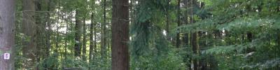
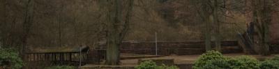
The „Kaltensteinpfad“, a Premium hiking trail labelled „Traumschleife“ (dream loop), has the shape of the figure eight. It leads past a historic horse trough, surrounded by majestic beech trees, the two “Kaltensteine”, impressive rock formations, and then up to the Hoxberg summit, whose 7,8 km long ascent is rather steep and strenuous. Different types of forest (e.g. primeval forest, enchanted forest) still show signs of the enormous destruction caused by two hurricanes in 1990. The Kaltenstein hiking trail is considered to be of intermediate difficulty; it was awarded 56 points by the German Hiking Institute (Deutsches Wanderinstitut).
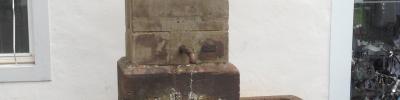
In the baroque historic centre of Blieskastel stands the most prominent fountain in town, Hercules’ Fountain. Johann Simon Rosinus, governor to the barons von der Leyen had it built in 1691, which makes it the oldest fountain still preserved to this day in Blieskastel. It dates back to the era of the Reunion policy of the French monarchy under Louis XIV (1679-1697), when Blieskastel was a French "Saar province". In the course of the centuries, the fountain had to be rebuilt several times. The Hercules statue which adorns it today is said to be the sixth. It is the work of the local sculptor Joachim Kisch, who created it in 1954 as a faithful copy of the predecessor model.
Der Erzgräberweg ist einer der Saar-Lor-Lux-Kulturwanderwege und führt zu den Zeugnissen der vorindustriellen Erzverhüttung in Schmelz. Startpunkt ist der Wanderparkplatz „Dreihausen" (Ambetstraße). Der Weg führt entlang des Sollbaches zu den aufgelassenen Erzgruben, die aufgrund ihrer Größe das Ausmaß der Abbautätigkeit erkennen lassen.
1748 verlegte Freiherr Lothar Franz von Kerpen (aufgrund seiner Funktionen als Beamter des Kurfürstentums Trier und als Ritterhauptmann des niederrheinischen Kantons der Reichsritterschaft) seinen Wohnsitz nach Koblenz, sodass ab diesem Zeitpunkt ein Amtmann der Burgverwaltung vorstand. Freiherr Franz Georg von Kerpen verlor 1794 durch den Einmarsch französischer Revolutionstruppen seine Hoheitsrechte als Landesherr, erhielt die Burg jedoch 1806 unter Napoleon als Privatbesitz zurück. Er starb im Jahr 1825 ohne männliche Nachkommen. Nachdem seine Töchter die Burg 1830 an den Bergrat Leopold Sello verkauft hatten, verfiel die Anlage rasch, da sie der Umgebung als Steinbruch diente. Anfang des 20. Jahrhunderts erwarb die Gemeinde Illingen den Komplex und leitete erste Sanierungsmaßnahmen ein. 1951 wurde der verbliebene Rundturm der Kernburg saniert und ist seitdem eines der Wahrzeichen von Illingen.
Der Bohnental-Rundwanderweg verbindet die fünf Orte des Bohnentals: Scheuern, Neipel, Dorf im Bohnental, Lindscheid und Überroth-Niederhofen. Zuwege von allen Ortsteilen sind angelegt. Die Wanderung geht über hügeliges Gelände mit mehreren Steigungen und ist als mittelschwer einzustufen.
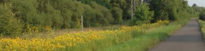
Der Bliesgau Radweg ist eine Rundtour durch den malerischen Bliesgau. Er startet in Richtung Blieskastel und führt dann auf den Saarland-Radweg auf der stillgelegten Bahntrasse durch das Bliestal.
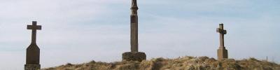
just outside the village of Kelberg, where the two-lane country road between Kelberg and Gerolstein takes a slight bend, the three historic calvaries can be found standing on a small hill.
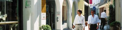
St. Johanner Markt is a market square in the very heart of Saarbrücken. As its name implies, it used to belong to the once independent municipality of St. Johann.

Merzig
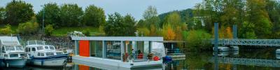
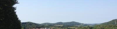
The district town of Merzig and its sights are situated on the river Saar, approximately 35 km south of Trier and 35 km northwest of Saarbrücken.